|
| |
|
Tribal Assessment |
|
Hawaiian Region |
|
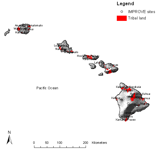
The following Class I areas are in the Hawaiian region:
Haleakala National Park
Hawaii Volcanoes
National Park
A very good detailed climate description for Hawaii with a Hawaiian flare can be
found at
http://www.wrcc.dri.edu/narratives/HAWAII.htm
Interested readers are encouraged to refer to this website. The following
description of the climate of Hawaii is taken from that account.
CLIMATIC REGIONS OF HAWAII
It is convenient to recognize seven climatic sub regions in Hawaii. These are
defined chiefly by the major physiographic features of the State and by location
with reference to windward or leeward exposure. Since one region grades into
another, it would be misleading to attempt to draw sharp boundaries between
adjacent regions. In general, however, the regions and their characteristics are
as follows:
(1) WINDWARD LOWLANDS, generally below 2,000 feet on the north to northeast
sides of the islands. This region lies more or less perpendicular to the
prevailing flow of the trade winds, and is moderately rainy, with frequent trade
wind showers. Partly cloudy to cloudy days are common. Temperatures are more
nearly uniform and mild than in other regions.
(2) LEEWARD LOWLANDS, except for the Kona coast of Hawaii which has a
distinctive climate. In these areas daytime temperatures are slightly higher and
nighttime temperatures are slightly lower than in windward locations. Dry
weather prevails except for occasional light trade wind showers which drift over
from the mountains to windward and for periods of major storms. In some leeward
areas an afternoon sea breeze in common, especially in summer
(3) INTERIOR LOWLANDS, on Oahu and Maui. In the northeast these lowlands have
the character of the windward lowlands; in the southwest, of leeward lowlands.
The central areas are intermediate in character, and – especially on Oahu – are
sometimes the scene of intense local afternoon showers from well-developed
clouds which form as a result of local heating of the land during the day.
(4) THE KONA COAST OF HAWAII. This is the only region in the islands where
summer rainfall exceeds winter rainfall. There is a marked diurnal wind regime,
with well-developed and reliable land and sea breezes, especially in the summer.
Summer is also the season with a high frequency of late afternoon or early
evening showers. Conditions are somewhat warmer and decidedly drier than in
windward locations.
(5) RAINY MOUNTAIN SLOPES ON LEEWARD SIDE. Rainfall and cloudiness are very
high, with considerable rain both winter and summer. Temperatures are equable.
Humidities are higher than in any other region.
(6) LOWER MOUNTAIN SLOPES ON LEEWARD SIDE. Rainfall is greater than on the
adjacent leeward lowlands, but distinctly less than at the same level on the
windward side except that the zone of maximum rainfall usually occurs just to
leeward of the crests of the lower mountains. Temperature extremes are greater
than on the rainy slopes of the windward sides of the mountains, and cloudiness
is almost as great.
(7) HIGH MOUNTAINS. Above 2,000 or 3,000 feet on the high mountains of Mauna
Kea, Mauna Loa, and Haleakala rainfall decreases rapidly with elevation. Near
the summits of Mauna Loa and Mauna Kea, rainfall is scant and skies are clear a
high percentage of the time. Relative humidities may reach values of ten percent
of less. The lowest temperatures in the State are experienced in this region,
with values below freezing being common.
THE CLIMATIC SETTING
The most prominent feature of the circulation of air across the tropical Pacific
is the persistent trade-wind flow in a general east-to-west direction. In the
central North Pacific the trade winds blow from the northeast quadrant, and
represent the outflow of air from the great region of high pressure, the Pacific
Anticyclone, whose typical location is well north and east of the Hawaiian
Island Chain. The Pacific High, and with it the trade-wind zone, moves north and
south with the sun, so that it reaches its northern-most position in the summer
half-year. This brings the heart of the trade winds across Hawaii during the
period May through September when the trades are prevalent 80 to 95 percent of
the time. From October through April, Hawaii is located to the north of the
heart of the trade winds. Nevertheless, the trades still blow across the islands
much of the time, though with a frequency that has decreased to 50 to 80 percent
in terms of average monthly values.
Besides the dominant trade winds, major storm systems may influence all parts of
the islands, and in some areas there is a local exchange of air between land and
sea on a rhythmic, diurnal basis. There is also the fundamental diurnal cycle of
night and day. Because Hawaii is at a relatively low latitude with respect to
the rest of the U.S., this cycle shows less variation in length than is found in
any other state. Major storms occur most frequently between October and March,
inclusive. During this period there may be two, three or even as many as six or
seven major storm events in any particular year. Such storms typically bring
heavy rains; and are sometimes accompanied by strong winds, at least on a local
scale. The storms may be associated with the passage of a cold front – the
leading edge of a mass of relatively cool air that is moving from west to east
of from northwest to southeast. The storms may also be associated with a large
eddy, or Low, that has been generated in the moving air in somewhat the same
manner that an eddy is generated in a flowing river. Moist, warm air swirling
into such eddies produces tremendous clouds and torrential rains.
Hawaiian land-and-sea circulations are on a far smaller scale than the
circulations of the major storm systems. The exchange of air often is confined
to areas of a few square miles or tens of square miles. Circulations of this
kind are most common on south and west coasts, in locations that are to the
leeward with reference to the trade winds and topographically sheltered from
them. The Kona Coast of Hawaii, the Lahaina District of Maui, the Ewa-Waianae
Coast of Oahu and the Barking Sands area of Kauai are among the localities in
which these circulations are common. These circulations have a will-marked
diurnal rhythm. Between forenoon and early evening air moves inland on a sea
breeze. Sometimes these sea breezes are fairly brisk. During the night and until
shortly after sunrise the sir drifts back from land to sea. The return drift is
usually very gentle, so much that it can barely be felt.
There in only a slight variation in length of night and day from one part of
Hawaii to another, since the major islands of the State all lie within a narrow
latitude band. The variations at Honolulu are therefore generally representative
of those of the State as a whole. The relatively constancy of the solar angle
result in relatively small variations in the amount of incoming solar energy
through the year.
The rugged configuration of the islands produces marked variations in conditions
from one locality to another. Air swept inland on the trade winds of as part of
storm circulations is shunted one way and another by the mountains and valleys
and great open slopes. This complex three-dimensional flow of air results in
striking differences from place to place in wind speed, cloudiness, and
rainfall. Together with variations in the elevation of the land, it results in
differences in air temperature. Thus the climatic pattern reflects not only such
dynamic elements as the trade-wind flow, the passage of storms, and the seasonal
rhythms of daylight and of solar heating, but also the static element of
topography.
In general, the Hawaiian climatic is characterized by a two-season year, by mild
and fairly uniform temperature conditions everywhere except at high elevations,
by striking marked geographic differences n rainfall by generally humid
conditions and high cloudiness except on the driest coasts and high elevations,
and by a general dominance of trade-wind flow especially at elevations below a
few thousand feet. How conditions differ in more detail from season to season
and place to place is evident from the following summary, which treats specific
aspects of the climate, discusses storms and other weather phenomena, and
distinguishes among the principal kinds of climatic regions of the State.
TEMPERATURE
An outstanding feature of the climatic regime of Hawaii is the small annual
temperature range, a consequence of the maritime influence. In downtown Honolulu
the warmest month is August, with an average temperature of about 78° F the
coldest, February, around 72° F – the range between the coldest and warmest
months averages only 6° F. At Hilo the range is 5.0° F and at Lihue, 8.0° F. It
seems likely that the range does not exceed 9° F at any location in Hawaii below
and elevation of 5,000 feet. While annual temperature ranges are almost as small
as this in a narrow zone bordering the coast of California, throughout virtually
all the remainder of the United States they are very much larger.
Outside the dry, leeward areas, temperatures of 90° F and above are quite
uncommon. In the leeward areas, temperatures in the low 90’s may be reached on
several days during the year, but temperatures higher than these are unusual. At
times the upper slopes of Mauna Kea and Mauna Loa are covered with snow during
the winter. It is possible that under favorable circumstances cold air formed
immediately above this snow cover on clear nights drains into local depressions
and accumulates to sufficient depths to produce temperatures of 5° F or lower at
the higher elevations. In exposed locations on the mountains, however, the cold
air formed locally is often swept away and replaced by the far warmer air that
is carried across and around the mountains by the upper winds; and the local
winds that tend to move down slope at night and upslope during the day also have
the effect of inhibiting the formation of extremely cold air. At elevations
below 1,000 feet, the lowest nighttime temperatures on record have been in the
50’s, except in relatively cloudiness areas such as central Maui and the leeward
coasts where temperatures in the high 40’s have been known to occur. Here again,
these are extreme values, and it is possible for several years to pass before
temperatures near 50° F are experienced in any locality near sea level. In
general, lowland temperature conditions in all but the driest areas are well
represented by the values for Honolulu, Hilo, and Lihue. Conditions in the
driest areas are well represented by the values given later for Mana, Kauai;
Waianae, Oahu; and Lahaina, Maui – all of which lie on leeward coasts in areas
that are very dry and relatively free of clouds.
WIND
Over the ocean around Hawaii average wind speeds are highest during the summer
trade-wind period. During the summer months (May through September) wind speeds
over the ocean exceed 12 miles per hour 50 percent of the time. Eighty to 95
percent of the time these winds (except as disturbed by terrain) are from the
northeast quadrant. During the winter (from October through April), when trade
winds are not quite as prevalent, wind speeds are in excess of 12 miles per hour
about 40 percent of the time. It is during this winter season that light
variable winds are most frequent and this more than balances the fact that
winter is also the time of occasional very strong winds – winds stronger than
those experienced during the summer except with the rare occurrence of a
tropical storm or hurricane in the summer period.
When the trade winds are moderate to strong – generally in excess of 14 miles
per hour – they dominate the flow of air across wide reaches of the lowlands. In
contrast, light trade winds are commonly felt only along the eastern to northern
coasts of the islands and in exposed locations in the hills. With such light
trades, there are often well defined local breezes along sheltered leeward
coasts; and in some areas, as on the Kona Coast of Hawaii and in the Kihei area
on Maui, these local sea and land breeze circulations occur not only when the
overall wind is light but also when the trade winds are moderate to strong.
Indeed, in these locations it appears that the local sea and land breezes may be
reinforced by the trades.
Because wind conditions at any one time may vary from place to place, the
frequencies at any one point are not representative of conditions everywhere in
Hawaii. On a few exposed headlands and in mountain passes so oriented as to
catch and concentrate the full force of the trades, winds above 40 MPH may occur
several days each month of the year. In nearly all other locations, however,
such winds occur only occasionally, and then only as the result of a major
storm, the passage of a cold front, or an unusual local situation. Major high
wind producing storms, discussed in a subsequent section, are chiefly events of
the winter season
The Kula winds are strong down slope winds. They occur in the Kula District
along a section of the lower slopes on the west side of Mt. Haleakala. According
to observations by inhabitants of the area, the winds tend to be strongest in
the zone that lies between 2,000 and 4,000 feet above mean sea level. In this
zone there may be episodes of down slope winds with speeds of over 40 MPH as
often as twice a year. However, winds with speeds n excess of 60 MPH probably
occur only once every four or five years, on the average.
The Lahaina winds seem also to be down slope winds, but of somewhat different
character from those of Kula. In the Lahaina area they have been given the name
of “lehua winds” after the lehua tree which grows in that locality and with
whose red blossoms the air is filled when these strong winds blow. They issue
from the canyons at the base of the main mountain mass of western Maui, where
the steeper canyon slopes meet the more gentle piedmont slope below. These winds
have been reported from both the western and southern side of the western Maui
mountains. They are evidently quite infrequent, occurring every eight to 12
years on the average. When they do occur, however, they are extremely violent,
with wind speeds whose effects suggest they may reach 80 to 100 MPH or even
more. They have been known to demolish buildings, uproot trees and cause severe
lodging throughout whole fields of sugarcane. That they are partly down slope
winds is evident from their being hot and dry. The mountains of western Maui are
less than 6,000 feet high as contrasted with the 10,000-foot height of Haleakala,
and it seems likely that these local Lahaina winds are caused, at least in part,
by the funneling of strong trade winds through certain of the mountain gorges.
Aside from the more violent mountain winds, there are light to moderate mountain
winds in many areas on the larger mountains of Hawaii and Maui and in a few
local areas in the smaller mountains of the other islands of the State. The
usual regime is to have upslope winds by day and down slope winds by night, and
this circulation takes its place with that of the sea-and-land breezes in
coastal locations as a finer, yet important, feature of the overall wind regime
of Hawaii.
INVERSIONS
A. Marine Layer
Under trade-wind conditions, there is very often a pronounced moisture
discontinuity at heights of between 4,000 and 8,000 feet. Below these heights
the air is moist; above it is dry. The break occurs in association with a
temperature inversion that is typically embedded in the moving trade-wind air,
and represents a large-scale feature of the Pacific Anticyclone. From the
surface up to the inversion, the temperature decreases with increasing height in
a quite uniform manner. The moisture is well distributed throughout this lower
layer, and the moisture content of the air is relatively high. At the base of
the inversion the temperature increases by several degrees, sometimes quite
suddenly. These higher temperatures may extend upward for several hundred feet
before the temperature begins once more to decrease upward, in the manner that
is most usual in the atmosphere. The significance of the inversion climatically
is that it tends not only to produce a lower, more moist layer as against a
higher, more dry layer, but it also tends to suppress the vertical movement of
air and hence to restrict cloud development to the zone beneath the base of the
inversion. When the inversion is present, as it is 50 to 70 percent of the time,
its height fluctuates from day to day, but it is usually between 5,000 and 7,000
feet. It is significant in this regard that the trade-wind inversion, which
tends to suppress vertical lifting of the air, is usually above the level of the
crests of the low mountains and is never above the level of the crests of the
high mountains.
The usual clarity of the air in the high mountains is associated with the low
moisture content of the air. Except for occasional periods of a few hours
duration, which seem to accompany the arrival of more moist air from below, the
relative humidity is generally below 40 percent, and it often falls to 10 or
even five percent. Such low humidities are characteristic of the zone above the
inversion that separates the lower and upper air. Thus, except on the high
mountains, the general regime in Hawaii is one of high humidity compared with
conditions in most other states.
B. Local Inversions
e.g within the crater. To be prepared, if necessary.
RAINFALL
If the islands of the State of Hawaii did not exist, the average annual rainfall
upon the water where the islands actually lie would be about 25 inches. Instead,
the actual average is about 70 inches. Thus the islands extract from the air
that passes across them about 45 inches of rainfall that otherwise would not
fall. At Mt. Waialeale, on Kauai, the annual average reaches the extraordinary
total of 486 inches – over 40 feet. This is the highest recorded annual average
in the world.
There are very few areas elsewhere in the World and none elsewhere in the United
States where rainfall gradients are as steep as they are in Hawaii. In a great
many places in Hawaii the annual rainfall gradient exceeds 25 inches per mile;
that is the rainfall increases 25 inches for each mile transversed along a
straight line. In a very extreme instance, the gradient is 118 inches per mile
along the 2-1/2 mile line from Hanalei Tunnel to My Waialeale on Kauai.
Seasonal/Diurnal Variations in Rainfall – Except for the Kona coast of Hawaii,
at elevations below 2,000 feet throughout the State winter is the season of
highest average rainfall. The Kona coast of Hawaii has a unique seasonal
rainfall regime. Here, summers are wetter than the winters. The summer maximum
on the Kona coast is associated with the facts that in the well-protected Kona
coast is associated with the facts that in the well-protected Kona area, which
lies to the leeward of Mauna Loa and Mauna Kea, there is a distinctive local
circulation. Daytime onshore breezes yield fairly regular and sometimes in
summer than winter. The winter storms that contribute the bulk of the average
annual rainfall in other lowland regions of the State contribute less rain to
the Kona coast.
In the lowlands at all times of the year, rainfall is most likely to occur
during the nighttime or in the morning hours and least likely to occur during
midafternoon. The more pronounced diurnal variations in summer is associated
with the fact that most summer rainfall consists of trade-winds showers and
these showers are most apt to occur at night. In winter most of the rainfall is
the lowlands occurs in general storm situations, and these are as likely to take
place during the daytime as at night.
STORMS
Most of the time the weather is dominated by the trade winds. Non-trade-wind
conditions are quite different. When the winds are light and variable, moist air
may move slowly onto the islands, typically from the southeast or south or
southwest. Then there may be intense local storms, sometimes accompanies by
lightning and thunder. These are usually small features that seldom cover more
than a few square miles or less. There are four classes of disturbances that
produce major storms. These four kinds of major disturbances are not always well
defined, but are nonetheless convenient classes for descriptive purposes.
The first type, Cold Front Storms, occurs when a cold front sweeps across the
islands bringing with it locally heavy showers and gusty winds. The second type
is known as the Kona storm. This term was originally reserved for the slowly
moving subtropical cyclones that occasionally enter the Hawaiian area, but is
now increasingly applied by the local public to any widespread rainstorm
accompanied by winds from a direction other than that of the trade winds. They
include situations in which the low-pressure area is not well marked, but
instead consists of a low-pressure trough into which air feeds from either side.
The third class of disturbance is the true tropical storm or hurricane. These
are rare, but may pass close enough to the islands to yield heavy rains, high
winds, and great waves upon the coasts. Also meriting treatment as a separate
and fourth class of disturbance are those instances of severe weather
attributable to low pressure systems (Lows and troughs) in the upper atmosphere
that are not associated with the foregoing cold fronts, Kona storms and tropical
storms or hurricanes. Of particular interest are those which occur when the
presence of trade winds in the lower atmosphere would appear to contraindicate
the likelihood of extensive heavy rain.
These types of storms are described in more detail in the description at the
website given at the beginning of this discussion.
|
|