|
Tribal Assessment |
|
The North Central Lowland Plains |
|
| Since we wanted to
statistically derive a correlation matrix for each region, we needed at
least four sites to in the correlation. There is only one site within
the region based on the physiographic boundaries. Based on proximity, terrain, and precipitation, we choose
BLMO1, VOYA1 and GRRI1 to include in the correlation. IMPROVE and IMPROVE
protocol sites used in this analysis are shown in this
map. |
|
| The details of the
correlation analysis are provided in tabular format below. The
Representative Distance (Rep. Dist.) is 285 km for this region.
Representative distances were based from exponential curve fits to the
correlation verses
distance curves. |
|
| Region |
|
Sulfate |
NO3 |
OMC |
LAC |
Soil |
CM |
Rep. Dist. |
| North Central Lowland Plains |
Distance (km) |
214.1 |
374.5 |
312.4 |
243.2 |
234.4 |
254.7 |
|
| |
Average (Mm-1) |
12.2 |
8.5 |
6.1 |
2.0 |
0.5 |
3.3 |
|
| |
Weighting |
0.381 |
0.265 |
0.189 |
0.062 |
0.015 |
0.103 |
|
| |
Weighted Dist. (km) |
81.6 |
99.4 |
59.2 |
15.1 |
3.4 |
26.1 |
285 |
|
|
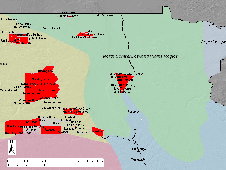
| Based on a representative
distance of 285 km, two tribal areas in the region are not represented by
an IMPROVE or IMPROVE protocol site as shown in this
summary map. |
|
 |
|
|
The following Class I areas are in the Central Great Plains region:
None The following are IMPROVE protocol sites:
None
|