|
| |
Conceptual
Model |
Site
Setting |
Aerosol
& Trends Analysis |
Backtrajectory
Analysis |
PMF
Analysis |
PMF Weighted
Backtrajectory Analysis |
|
| |
| St. Marks
Wilderness Area |
| |
|
The St. Marks Wilderness Area is located at the eastern
edge of the Florida
Panhandle on the Gulf coast approximately 25 miles south of Tallahassee. The wilderness is
part of the 68,931 acre St. Marks National Wildlife Refuge. The wilderness area
consists of approximately 17,745 acres of salt water bays, estuaries and
brackish marshes. The wilderness is divided into two units: the St. Marks
unit to the east and a smaller unit to the west near the Ochlockonee Bay. The IMPROVE site is located
in a forest clearing 3 miles south of the visitor center at the refuge near
highway 59. The IMPROVE
site is located at an elevation of 8 m MSL. The state of Florida DEP
operates an ozone and meteorological station within close proximity. |
|
| Descriptive analysis maps for
St. Marks Wilderness Area can
be viewed in the
map
gallery page. Site metadata and photos from
VIEWS. |
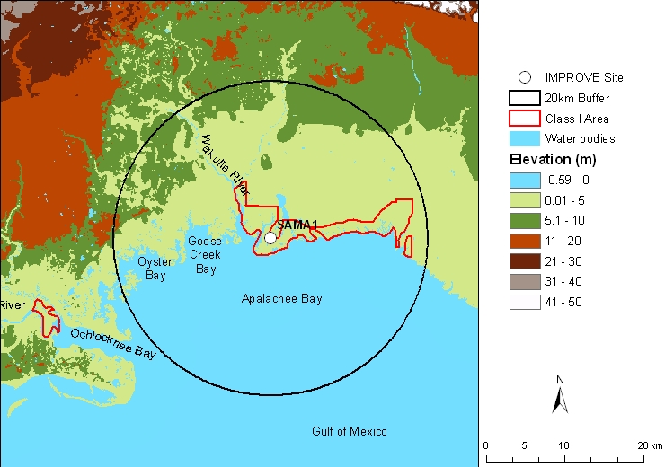 |
| Figure 1. Terrain and land
features surrounding the St. Marks Wilderness Area |
|
|
Last updated 11 December 2006
|