|
| |
Conceptual
Model |
Site
Setting |
Aerosol
& Trends Analysis |
Backtrajectory
Analysis |
PMF
Analysis |
PMF Weighted
Backtrajectory Analysis |
|
| |
| Seney Wilderness
Area |
| |
|
Seney Wilderness Area is located in Michigan's Upper
Peninsula. The wilderness is approximately 80 miles west of Sault Ste. Marie,
Michigan. The wilderness covers an area of 25,250 acre and part of the
95,455 acre Seney National Wildlife Refuge. The wilderness consisting of
open marshes with intermittent sandy islands or string bogs. The IMPROVE
site is located in a small cleared area surrounded by woodlands west of
state highway 77 near the lookout tower. The IMPROVE site is located at an
elevation of 215 m MSL. There is a
visibility camera
(north of the IMPROVE site) that
looks out toward the north. |
|
| Descriptive analysis maps for
Seney Wilderness Area can
be viewed in the
map
gallery page. Site metadata and photos from
VIEWS. |
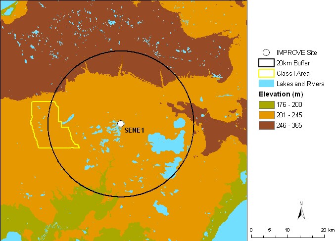 |
| Figure 1. Terrain and land
features surrounding the Seney Wilderness Area |
|
|
Last updated 9 February 2007
|