|
| |
Conceptual
Model |
Site
Setting |
Aerosol
& Trends Analysis |
Backtrajectory
Analysis |
PMF
Analysis |
PMF Weighted
Backtrajectory Analysis |
|
|
|
| Wichita Mountains
Wilderness Area |
|
|
The Wichita Mountains IMPROVE
site is in a broad drainage in the Wichita Mountains. It is located on the
lower slopes of Elk Mountain at an elevation of 518 m (1,699 ft). Valley
bottom elevations in the vicinity are near 500 m (1,640 ft). Mountain summit
elevations south of the drainage are near 650 to 680 m (2,130 to 2,230 ft).
To the north terrain rises to 650 to 700 m (2,130 to 2,300 ft) at distances
~ 3 to 5 km (2 to 3 mi). The terrain is thus a generally WNW to ESE oriented
valley, draining to the WSW toward the town of Lawton. Ground cover is
predominantly grassland, with scattered patches of forest. |
|
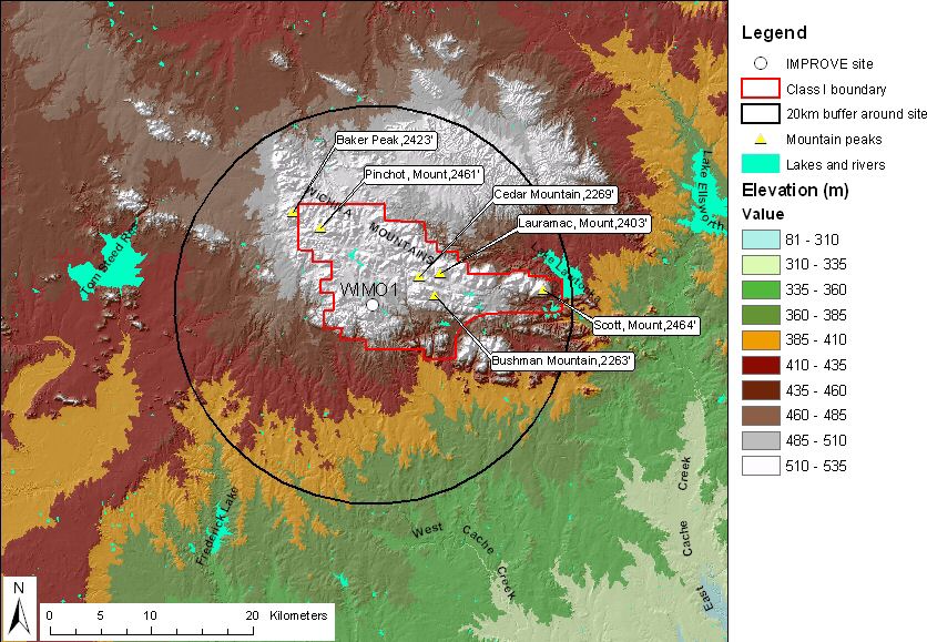 |
| Figure 1. Terrain and land
features surrounding the Wichita Mountains sampling site |
|
| Descriptive analysis maps for
Wichita Mountains can
be viewed in the
map gallery page. Site metadata and photos from
VIEWS. |
|