|
| |
|
|
| Hualapai
Tribe |
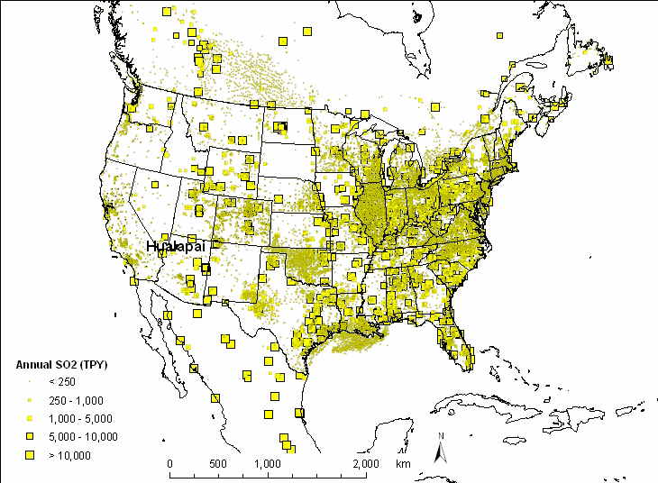
Case study analysis has shown that eastern US SO2 sources can dominate
sulfate concentrations on high sulfate days as far west as Grand Canyon
National Park.
|
| |
| Major emission source types and source regions
responsible for haze |
| |
 |
|
|
|
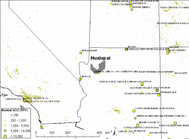
There are several coal fired power plants in the region, including the
Navajo generating
station near Page, Arizona, some ~ 100 km to the north near the Colorado
River. SO2 emissions from the Navajo plant have in the past been a major
concern with respect to haze and visibility in the Grand Canyon. Emissions
from the Navajo plant have been drastically reduced since completion of the
Navajo
Scrubber Project in 1999. Other major point sources potentially
affecting the area include the
Mojave Generating Station
in southern Nevada, and the Four
Corners and San Juan power
plants in northwestern New Mexico.
|
| |
| The town of Peach Springs is located in the southern portion of the
reservation on Route 66. Kingman Arizona the nearest major population center
is 50 miles southeast of the reservation.
Local sources of particulate matter that have been identified as possible
contributors to visibility impairment in Grand Canyon NP include road dust
and wildland fires (Grand
Canyon Visibility Transport Commission). The Navajo power plant might
also be considered a local source in view of its proximity to the Colorado
River drainage a short distance upstream from Grand Canyon NP. |
  |
|
|
|
More text
|
Last updated 20 May 2005
|

