|
| |
|
|
| |
| Spokane |
| |
The
Spokane Indian Reservation is located in northeastern Washington, 100 km (60
mi) northwest of the city of Spokane. It is bordered on the south by the
Spokane River and on the west by the Columbia River. The mouth of the
Spokane River at its junction with the Columbia River is at the westernmost
Reservation boundary. Terrain is mountaints and eroded Plateau. Elevation at
Columbia River level is ~ 400 m. Highest ridge crest elevations are near
1,000 m. The elevation of Spokane Mountain in the western area of the
Reservation is 1,180 m.
The
SPOK1 IMPROVE protocol site is a tribal site, elevation 548 m (1,797 ft)
near the center of a wide (7 km) flat valley bottom, Chamokane Creek, near
the eastern Reservation boundary. Surrounding terrain rises to 700 to 750 m
on the west ridge, 750 to 800 m on the east ridge. |
|
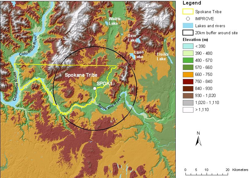 |
| Figure 1. Terrain and land
features surrounding Spokane |
|
| Site metadata and photos from
VIEWS |
|
|
|
|
| |
|
Last updated 8 June 2005
|

