|
| |
|
|
| Flathead |
| |
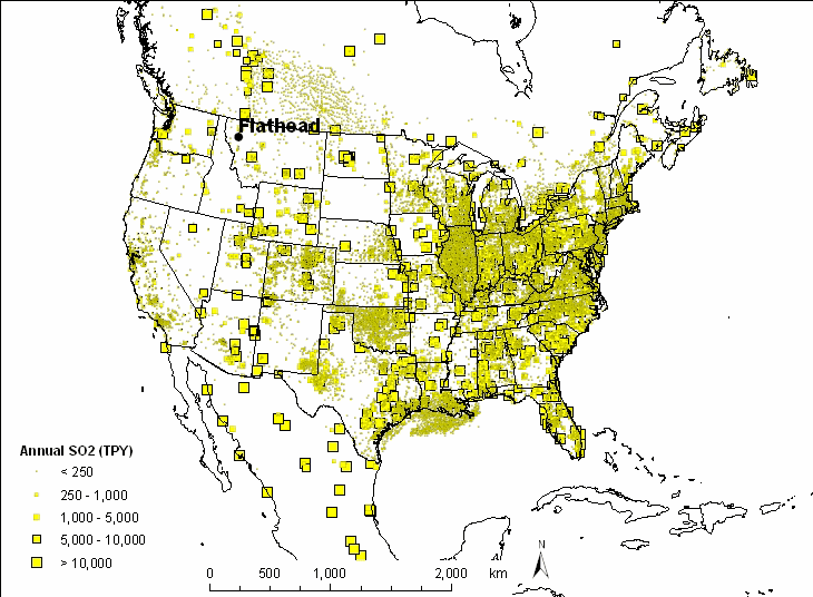
| Major emission source types and source regions
responsible for haze |
| |
| This western Montana area is remote from any major source
regions. The nearest major population center is Missoula, 100 km south of
FLAT1. |
| |
 |
| |
| |
|
|
| |
| |
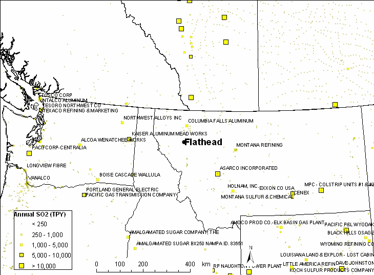
| Based on the WRAP emission inventory for SO2, there
are a few large point sources in the region. North of the site is the
Columbia Falls Aluminum plant at 74 km. Asarco Incorporated's plant
southeast of the site is approximately 200 km. West of the site is
Kaiser Aluminum Mead Works at 232 km and Northwest Alloys Inc at 274 km.
The nearest major population center is Missoula, 100 km south with a 2000
census of 57,053. The city of Kalispell is north of the site at
approximately 45 km with a 2000 population of 16,391.
|
| |
| |
| |
|
|
| |
|
|
|
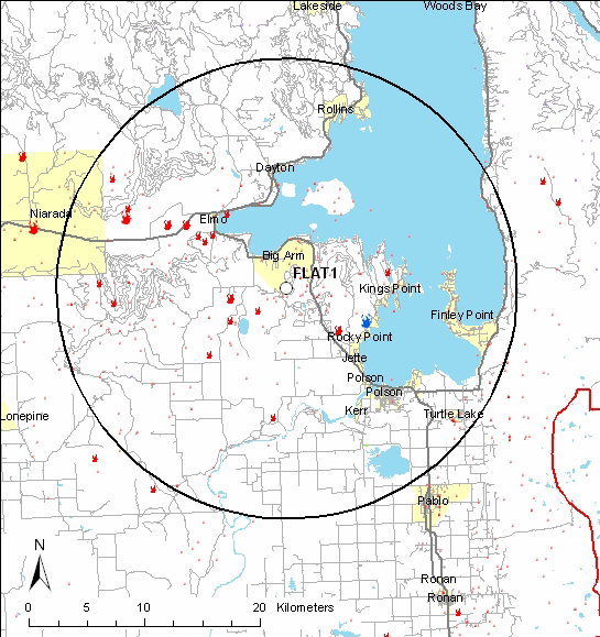
| The map below shows point
source emissions as well as wildfires within 20 kilometers of the FLAT1
IMPROVE site. Fires shown in the map below are reported in the NIFC
wildfire database since 1997. Nearby populated areas include Big Arm
(pop. 131), Elmo (pop. 143), Finley Point (pop. 493), Polson (pop. 4,041)
and Pablo (pop. 1,814). Based on a
1990 aerial photo from
the USGS the nearest residences within 2 kilometers are located southeast of
the monitoring site. |
  |
|
|
| |
|
Last updated 1 June 2005
|

