|
| |
|
|
| Fort Peck |
|
| Major emission source types and source regions
responsible for haze |
|
|
| This eastern Montana area is remote from any major source
regions. The nearest major population center is Regina, Saskatchawan (1996
pop. census 193,652) 241 km north of
FOPE1. |
 |
|
|
|
|
| |
| |
|
| |
| |
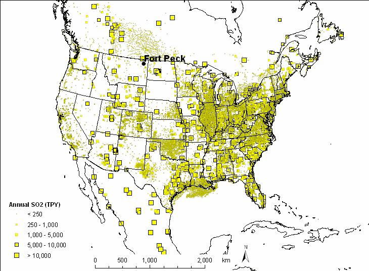
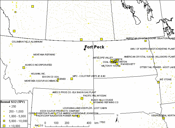
| Based on the WRAP emission inventory for SO2, there
are a several large point sources in the region as shown in the figure below.
Point sources with annual SO2 of 5,000 tons per year are labeled in the US.
Southeast of the site are the Coal operations in North Dakota. Point
sources in that group include the
Antelope Valley Station,
Coyote Station,
Leland Olds Station, Dakota Gasification Company,
Milton R. Young Station,
Stanton Station,
R.M. Heskett Station and the
Coal Creek Station. The nearest significant population center is
Williston, North Dakota, 110 km east with a 2000
census of 12,512. The Regional Modeling Center
TSSA suggests that the sources of nitrates and sulfates are point
sources in Montana, North Dakota and "other." |
|
|
| |
|
|
| |
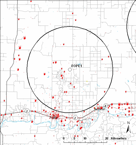
| The map below shows point
source emissions as well as wildfires within 20 kilometers of the FOPE1
IMPROVE site. Fires shown in the map below are reported in the NIFC
wildfire database since 1997. Nearby populated areas include Poplar
(pop. 911) and Brockton (pop. 245). Based on a
1996 aerial photo from
the USGS the nearest residences within 2 kilometers are located northeast of
the monitoring site. |
 |
 |
|
|
|
|
Last updated 8 June 2005
|

