|
| |
|
|
| Fort Peck |
| |
The Fort Peck Reservation is
in northeastern Montana, 40 miles west of the North Dakota border, and 50
miles south of the Canadian border, with the Missouri River defining its
southern perimeter. It includes more than two million acres of land.
The Fort Peck Tribe IMPROVE site
FOPE1 is located in the east part of the Reservation. It is on flat land
400 m west of Poplar River and 23 km north of the Missouri River. Site
elevation is ~ 638 m (2093 ft). The surrounding terrain is flat. The site
thus has good exposure to regional scale transport winds. Surrounding
terrain is predominantly agricultural land and moderate grassland. |
|
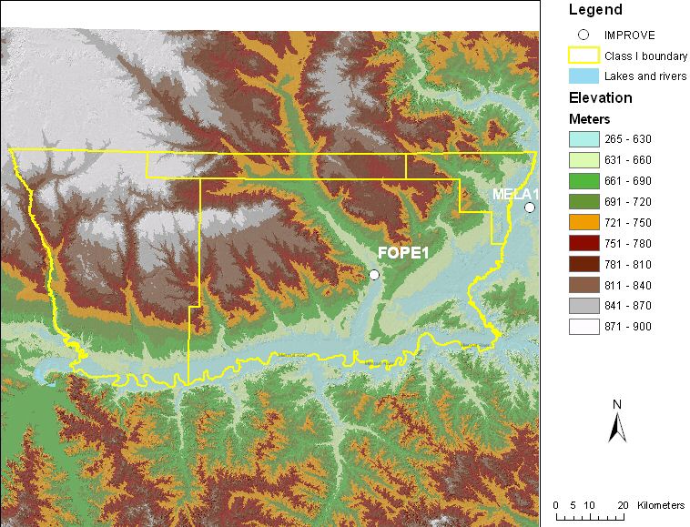 |
| Figure 1. Terrain and land
features surrounding the Fort Peck sampling site |
|
| Site metadata and photos from
VIEWS |
|
|
|
| |
|
Last updated 20 May 2005
|

